


成都梦之旅文君楼宾馆ChengDu Dreams Travel Wenjun Mansion Hotel
开业时间:2006年 / 客栈类型:特色客栈 / 房间:25套 / 地址:成都市青羊区琴台路180号查看地图


不错典型的中式客栈服务一流闹中取静悠闲,舒适巴适交通很方便何师的菜很好吃古代Style很好很强大有2个免费大公园就在地铁2号线旁边我喜欢最新装修客栈不错下次还会去住
喜欢这个客栈的人
8人喜欢这个客栈
- 客栈房型及价格
- 预订须知:
- 优惠政策:
| 房间类型 | 面积 | 卫生间 | 空调 | 上网 | 床型 | 早餐 | 时间段 | 梦之旅特价 | ||
|---|---|---|---|---|---|---|---|---|---|---|
舒适大床房 更多图片 | 25 | 有 | 有 | 有 | 1.5米大床 | 无 |
| 立即预订 | ||
豪华阳台双床房 更多图片 | 40 | 有 | 有 | 有 | 二张1.2米床 | 无 |
| 立即预订 | ||
豪华阳台大床房 更多图片 | 40 | 有 | 有 | 有 | 1张1.8m大床 | 无 |
| 立即预订 | ||
温情亲子房 更多图片 | 48 | 有 | 有 | 有 | 1张1.8m大床,1张1.2m标准床 | 无 |
| 立即预订 | ||
商旅三人房 更多图片 | 45 | 有 | 有 | 有 | 3张1.2m标准床 | 无 |
| 立即预订 | ||
双阳台观景套房 更多图片 | 50 | 有 | 有 | 有 | 1.1*2张 1.5m罗汉床 | 无 |
| 立即预订 | ||
豪华家庭四人套房 更多图片 | 60m² | 有 | 有 | 有 | 1张1.8m大床,2张1.1m标准床 | 无 |
| 立即预订 | ||


- 梦之旅游客2017-06-14 20:46:23
我想预订呀
- 梦之旅游客2017-06-14 20:46:02
你们官网上的价格与携程上的价格是一样吗?
- 梦之旅游客2015-06-29 15:41:43
我打算10月入住,要提前订房吗?
- 梦之旅游客2014-03-21 12:58:28
请查詢我的訂單:H10001428 我已用网上銀行預付订金,可是在我的订单里仍然显示未付款,怎么回事?另外,订单H10001427 为重复订单,请取消,谢谢!
- 梦之旅游客2014-02-06 19:27:43
您好 我們來自台灣 想預定3/12入住的普通双人標準間一間 因為沒有大陸手機 無法在你們官網預訂 是否可幫我訂房 現場再支付入住房間費用 請與我聯絡 台灣手機:0975-582317 E-mail: jungl1@ms4.hinet.net 李先生 另外我想預定3/12晚上 2張蜀風雅韻的門票 謝謝
- 梦之旅游客2013-11-12 20:51:19
老板,您好!我预订了11月16日和17日的房间,请问可以安排接飞机吗?我看到网上有这个优惠活动。盼复~
回复内容:您好!感谢您对成都文君楼宾馆的信任和支持!稍后我们的工作人员会和您联系,如有其它问题请来电咨询。电话:028-861387852013-11-13 15:11:21
- 梦之旅游客2013-10-23 18:38:59
谢谢您的回复,我的订单号为H10000890,因连续入住2晚(支付定金),可享受免费的接机,我们希望贵酒店可按排接机,但我们无法用信用卡支付定金,如何付钱呢?
回复内容:您好 这里是北京梦之旅客服,成都梦之旅请咨询成都梦之旅客服 如果有任何问题请您咨询前台电话 24小时 010-58433243 北京梦之旅酒店前台 吴小姐 2013-10-24 10:28:54
- 梦之旅游客2013-10-21 20:15:52
我们是来自马来西亚的游客, 订单号为H10000890,但我们无法用信用卡支付,如何付钱呢?
回复内容:您的预订得到确认后,可以不用支付,直接前来酒店入住即可2013-10-23 14:21:53
- 梦之旅游客2013-10-20 13:07:09
我们是来自马来西亚的游客。 想要在11月3日(1晚)和11月5日到6日(2晚)预定双人大床房。 1。请问还有空房吗? 2.11月4日我们将会前往峨眉山, 请问能寄放行李吗? 3。请问连续入住2晚能有免费接机服务吗?
回复内容:您好 现在可以预订,有房间。行李可以寄存,如果寄存超过一天,要按件收费。梦之旅现在还没有接机服务。如果有任何问题请您咨询前台电话 24小时 010-58433243 北京梦之旅酒店前台 吴小姐2013-10-21 09:38:00
- 梦之旅游客2013-09-11 15:21:53
我是马来西亚,要如何还钱呢?
回复内容:您好,您可以选择支付宝和信用卡支付,如果在支付过程中有任何问题请及时与我们联系,谢谢。2013-09-18 19:05:48
- 梦之旅游客2013-06-28 18:15:00
你好,我的订单日期填错了,如何修改入住时间呢
- 梦之旅游客2013-02-23 17:05:30
觉得你们家挺好的,出行方便,所以加订了几天,老板要多关注哦~
回复内容:感谢支持哦,如果觉得我们好就多帮我宣传宣传哦~2013-02-23 17:11:09
- 梦之旅游客2013-02-20 14:15:38
老板,您好!我预订了明天的房间,请问可以安排接飞机吗?我看到网上有这个优惠活动。盼复~
回复内容:蓝色天空,新年好!已经查看到您的了订单了,您的预订条件已经达到了免费接飞机的条件,所以接下来只需要您将准确航班号告诉我们,我们就可以安排车子到机场去接你们了。另外,下飞机后请保持手机畅通,以便我们的司机与你们联系。文君楼全体员工期待你们的光临!2013-02-20 14:55:00
- 梦之旅游客2013-02-14 14:40:56
我们是后天准备入住的客人,想去看大熊猫和变脸表演和去周边的古镇逛逛,不知道是否有好的推荐呢?
回复内容:春暖花开,新年好!非常感谢您对我们的支持,也非常欢迎您到四川旅游。想去看大熊猫和游古镇的话,酒店旅行社都是可以为您安排的,比如,熊猫基地+古镇1日游(黄龙溪古镇或者洛带古镇可以2选1),228元/人,包含往返车费+门票,每天早上出发,下午6点左右就可以返回到酒店了。另外,在酒店前台也可以买到川戏表演特价门票(包括变脸、吐火、滚灯、木偶戏、手影戏等),80元/人。2013-02-14 14:51:02
- 梦之旅游客2013-02-14 11:26:36
原计划去九寨沟,但是朋友告诉我要夏天去好些,请问现在九寨沟值得去嘛?
回复内容:小雨明,新年好!九寨沟一年四季都很漂亮,现在去正好可以看雪景,人也不会很多,所以如果有时间的话可以去看看~冬天也是值得推荐的~ 2013-02-14 14:41:32
- 梦之旅游客2013-02-14 11:21:06
请问一下你们周围都有些什么好吃的可以推荐?
回复内容:小楼,新年好!文君楼附近有很多好吃的,比如:龙森园火锅、狮子楼火锅、皇城老妈火锅,以及在琴台路附近的西安南路上,有非常好吃的肥肠粉、铺盖面以及很多地道的川菜馆。如果有机会一定要去品尝哦~2013-02-14 12:14:52
- 梦之旅游客2013-02-07 16:30:23
请问1月18日还有房吗?我们准备自驾到成都,大概有6-7人。
回复内容:新年好!18号现在看来还有房间可以接受预订,如果需要预订房间请及时与我们联系,订房电话:028-861366642013-02-08 17:52:31
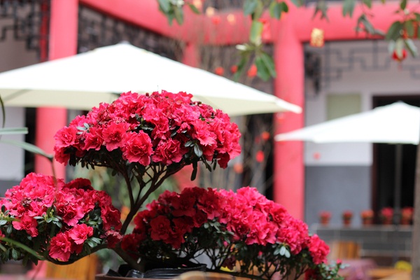
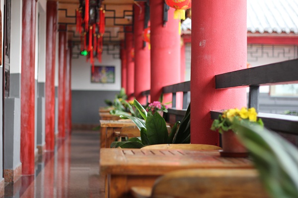
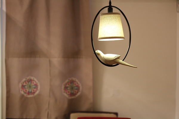
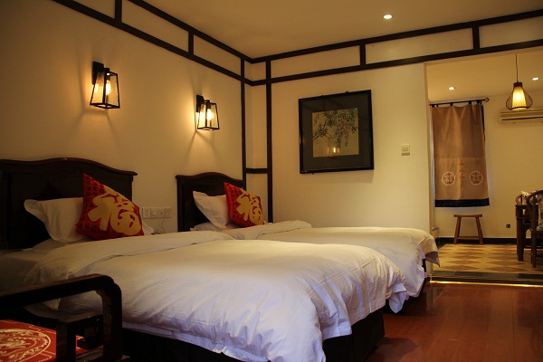
- 客栈图片


- 交通信息
- 要到达琴台路可以乘坐以下公交车辆: 27路或34路公交车(青羊宫站下) 11路公交车(青羊宫站下) 81路公交车(通惠门站下) 58路公交车(通惠门站下) 64路公交车(通惠门站下) 47路公交车(通惠门站下) 13路公交车(通惠门站下) 详细地址:四川省成都市琴台路180号(原12号)
订单列表
- WONG LAI KI*,2月前,预订12月23日豪华标间,13316***025,未确认
- 刘*,2月前,预订08月13日标准间B,18782***916,未确认
- Zunair Hassa*,2月前,预订11月12日空调四人间,13609***637,未确认
- zFPWdwP*,2月前,预订09月05日标准间,987-6***329,未确认
- zFPWdwP*,2月前,预订09月05日标准间,987-6***329,未确认
- zFPWdwP*,2月前,预订09月05日标准间,987-6***329,未确认
- PJztEXf*,2月前,预订09月05日双阳台观景套房,987-6***329,未确认
- PJztEXf*,2月前,预订09月05日豪华家庭四人套房,987-6***329,未确认
- PJztEXf*,2月前,预订09月05日标准间,987-6***329,未确认
- PJztEXf*,2月前,预订09月05日标准间,987-6***329,未确认
客栈总评分
95.83%
特色100.00%
位置100.00%
趣味90.00%
清洁90.00%
员工100.00%
安全95.00%
- 共4条入住点评我要点评

2016-01-01 00:47:22
满意度:86.67% 特色:满意 位置:满意 趣味:一般 清洁:满意 员工:满意 安全:满意
2014-08-04 17:03:19
满意度:100% 特色:满意 位置:满意 趣味:满意 清洁:满意 员工:满意 安全:满意
Roy 2014-05-25 19:06:23
满意度:100% 特色:满意 位置:满意 趣味:满意 清洁:满意 员工:满意 安全:满意
Yichu 2014-02-25 16:26:33
满意度:96.67% 特色:满意 位置:满意 趣味:满意 清洁:满意 员工:满意 安全:满意
- 4 条记录 1/1 页
最新旅游资讯
想定制四川旅游行程吗?请找成都地接旅行社,一手资源,一手地接,欢迎来四川旅行!寻找四川地接社?成都地接旅行社哪家好?找哪家四川地接旅行社靠谱?四川康养之旅-四川地接,成都康养旅游,避暑旅游团,梦之旅-康养之旅加盟梦之旅,三步曲,一步也不能少1212121新年之际,感恩所有的梦之旅家人们!四川红色旅游线路,四川红色旅游景点,四川地接旅行社红色之旅,四川将帅故里之旅【298元,超值西部大峡谷温泉二日游,纯玩+零自费+45个露天温泉池+不限次数+不限时间+升级自助午餐+自助早餐+大峡谷观光+邵女坪观光】秦皇岛.北戴河避暑旅居介绍,推荐秦皇岛+北戴河+承德避暑山庄+坝上草原梦之旅-神州国旅五一节部份精彩线路推荐,51节旅游,省内省外,精彩纷呈,总有一条合您心意!来吧,让我们过一个欢乐的五一假期- 我浏览过的客栈